Showing posts with label Indonesia Tourism. Show all posts

Baluran National Park


This park is a forest preservation area that extends about 25.000 ha on the north coast of East Java. The location is in Sumberwaru village, Banyuwangi district, Situbondo (on the east border of Java Island). You can enjoy the panorama of savannah and mount Baluran (inactive volcano) in the center of area that becomes habitat of many exotic animals such as wild pigs, deer, peacocks, wild chicken, some species of monkeys and also bulls as the protected animals in the area.

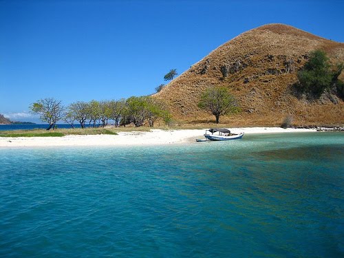
You can enjoy the amazing scenery of the forest and do the safari activities in the wild life and feel the magic of the forest. This park is so unique because 15 km from the main entrance, you can find a beautiful white beach called Bama Beach, here in the habiat of coral reef, fish and mangrove.

You also can observe hundreds species of birds such as hornbills, peacocks and bulbuls. If you like to observe the tropical forest vegetation, the park is a heaven for many species of trees, plants and flowers such as pecan nut trees, Maja, Gadung, Java tamarind trees and mount Widara.

There are several activities that you can do in this park such as: - Safari Forest - forest adventure - Diving and snorkeling - Mountain hiking and mount climbing - Hill walking - Beach adventure to watch the fishermen's daily activities and seed seekers - Canoeing, rowing or boating until you the Fresh Water Gulf, Sejile Gulf and Bilik Beach.

*
Conducting some scientific researching (with prior permission).
Facillities
*
If you prefer to safari to Baluran National Park, there are some cottage designed in Madurese style and operated by Environmental Education Center. There is also a main lodge that will serve you European and Indonesia cuisine.
*
Villas and lodges, you can rent them with your group members (about 20 persons capacity) and the also provide a praying room and a canteen.
*
There are two guesthouses by the beach, but you should have prior reservation.
*
Baluran Information Centre and a small museum that has several preserved animals by the main entrance operated by The Forestry Conservation Region Office.
*
The visitor can do many activities, such as; Diving, Swimming, boating, snorkeling
*
Playground
*
A beautiful camping area that is located in Sumberwaru village (outside of the forest preservation area)
*
Watching Towers that are usually used by rangers to watch or to observe the animals' behaviors and the region surrounding (you can bring a pair of binoculars or telescope to have a better look at the beautiful panorama)

Try to consider the wide ranges of this area, you will be better visit Baluran by your car or rent a car from Denpasar or Surabaya. You can also rent a car at Pasir Putih tourist resort or Situbondo. There is also motorbike public transportation called “ojek” in the main entrance that will take you to Bama Beach (with Negotiated cost)

The Route
o If you take a car, it takes 5 hours from Surabaya and 4 hours from Denpasar, Bali.
o For tourists who stay in Pasir Putih, it takes 1.5 hours and only 1 hours from Situbondo.

Gua Jepang (Japan Cave)
In Baluran National Park, you can see a historical place called “Gua Jepang” (Japan Cave). Gua Jepang is one of historical witness that in this place (Baluran National Park) was happened battle between Indonesia army against Japanese army. Because unequal power, there are a lot of Indonesia army who died in that battle, so this place also called Batangan. Gua Jepang has wide about 12 km that contains in 2 chambers. The north chamber was used to save the weapon, while the south chamber was used as a fissure to see an enemy.

Bekol Savannah
Beside Gua Jepang, in the Baluran National Park, you also can see Bekol savannah. It's about 12 km from the entrance Baluran National park. You will see a flock of deer, bulls, etc, in the morning and in the afternoon (when the sun goes down) to do their activity. You also can see their activity and behavior of those animals from the height.

Bama Beach
Bama beach is located in the east of Baluran National Park. You can see the original beach and the fantastic panorama in here. Beside that you can see the mangrove forest, Bama source and Mantingan source. One of special moment here is that you can see monkey with the long tail (Macaca fascicularis) that fishing crabs with their long tail. If you like go on food, you can pass the truck and you can see the beautiful panorama of Bama Beach on the height. Just with 15,000 Rupiahs per person you can spend the night in Bama Beach to enjoy the beautiful panorama at night here.
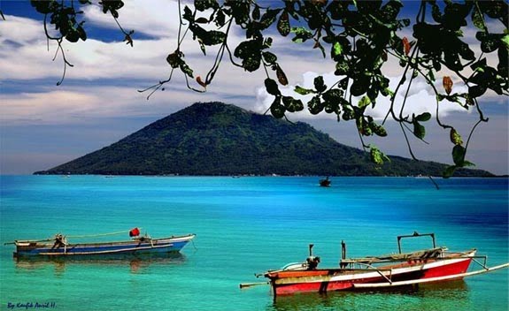
Bunaken Sail


Ever fancy yourself being a mermaid? Being able to swim along with other creatures of the sea , moving to the rhythm of the waves? In the Bunaken Marine Park, you will encounter a real “mermaid”, and you can also get a glimpse of sea life here.

Bunaken is an 8.08 km² island in the Bay of Manado, situated in the north of the island of Sulawesi, Indonesia. Bunaken forms part of the administrative city of Manado , capital of North Sulawesi. The marine Park around Bunaken is part of the National Park that also includes the ocean around the island of Manado Tua – or Old Manado, Siladen and Mantehage.

Within the Bunaken Marine Park, visitors can see various strange and colourful marine life along its sea bed. To reach this park, you can take a motorboat. The journey from Manado takes around 40 minutes. Entrance fee is 25,000 rupiahs per person per visit.

The translucent waters of the Bunaken seas enable people to clearly view numerous sea biota. There are 13 species of coral reefs in this park, dominated by edge ridges and block ridges of rocks. The most attractive view is the steep vertical sloppy coral reef that plunges down as deep as 25-50 meters.

Feast your eyes on 91 types of fish found in the Bunaken National Park, amongst which are the locally known gusimi horse fish (Hippocampus), the white oci (Seriola rivoliana), yellow-tailed lolosi (Lutjanus kasmira), goropa (Ephinephelus spilotoceps and Pseudanthias hypselosoma), ila gasi (Scolopsis bilineatus) and others.

Divers may also meet mollusk like the giant kima (Tridacna gigas), goat head (Cassis cornuta), nautilus (Nautilus pompillius) and tunikates/ascidian.

For those who enjoy scuba diving, this is a great place to be. With about 20 dive spots to choose from, divers will have the chance to swim below the sea, and frolic joyfully while admiring the sea creatures.

Make sure to visit Bunaken during its best season between May to August. That way you can explore the Park to its fullest.

Ijen Plateau


Ijen Plateau- Home-Grown Sulfur

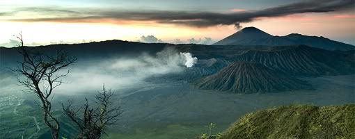
Ijen plateau or known as "Kawah Ijen" is highly recommended to mountain buffs and hikers. The Plateau was at one time a huge active crater, 134 sq km in area. Today, Ijen is a quiet but active volcano, and the landscape is dominated by the volcanic cones of Ijen (2,368 asl) and Merapi (2,800 asl) on the northeastern edge of the Plateau, and Raung (3,332 asl) on the southwest corner.
The magnificent turquoise sulfur lake of Kawah Ijen lies at 2148 m above sea level and is surrounded by the volcanos sheer crater walls. The vent is a source of sulfur and collectors work here, making the trek up to the crater and down to the lake every day. Sulfur collectors hike up in the morning and return around 1 pm when the clouds roll in. They carry shoulder basket of pure sulfur from a quarry on the lakes edge under the shadow of the sheer walls of the crater. The mineral at Kawah Ijen is purer and is worth commercial exploitation despite the horrendous labor involved: Javas homegrown sulfur is a natural source of sulfuric acid, in great demand in the oil-refining business and in the production of fertilizers.

Getting There

The Ijen Plateau can be reached through Bondowoso from either the northern or the southern coast. It is closer to Banyuwangi, but the road is very steep and badly deteriorated. A 4 WD is essential, although difficult to hire in Banyuwangi and outrageously expensive. Most people walk the last 8 km along the road to Pos Paltuding (the PHPA Post, the starting point or the trek to the crater).

Where to Stay

You can choose your places of stay at Bondowoso or Banyuwangi. There's a few type of accommodation with varied price and facilities.

Moving Around

You can take a walk for about 1-1 1/2 hour to the crater rim.

Dining Guide

Before start trekking, hiking or climbing, be sure that you have already eaten, or you can bring some food and drink from your places.of stay. Otherwise, you can buy some food and non alcoholic drink on the nearest supermarkets for your supply during your activities on mountain.

Souvenir Tips

The sulphur diggers will approach you for playing a guide and sell some nice sulphur statues for 5.000 till 10.000 Rp (probably their day-income).

Other Things to See or Do

At the rim itself you have a nice view on the lake. You can walk around the rim or go immediately left so you can walk down to the lake for about 40 minutes.

Travel Tips

*
The walk starts at Pal Tuding. Its a basic camp where you can stay overnight. There is a block with showers and toilets
*
At night it can be pretty cold up there,(it is suggested that you carry a sleeping bag). Take your own picnic, since the food you can buy at the parking lot isn't up to much.
*
The walk up to the crater rim takes 60-90 minutes. It's pretty steep. Halfway is a small post where the sulphurworkers take a break. A cup of tea is available here.
*
The path is just one-way so there is no need for any guidance.
*
An absolute must is a handkerchief to put in front of your mouth and nose to avoid inhalation of the sulphur gases.
*
If you buy some souvenirs like statues, they are very breakable so tape them in with toilet paper and take precious care of it.

Heritage


Jajaghu Temple

Jajaghu or Jago temple was constructed in 1275 - 1300 AD. It believed as the burial place of King Wisnuwardhana ashes, the fourth king of Singosari kingdom. The temple itself has three famous reliefs and each relief has their own story.

Kunjakarna relief which tells us about Kunjakarna who is doing Buddha meditation in Mt. Semeru in order to be free of his demon mind in the next incarnation. The second relief is about Arjuna journey to Indrakila mountain to train himself so he could be able to get Siva’s help and in this relief, it is told that Arjuna is succeed. Krisnayana relief is the third relief and it tells us about the marriage between Maharaja Wisnuwarddhana and his wife Nararya Waning Hyun in which symbolized the marriage between Visnu the God and Sri the Goddess.

There is also one remained statue in the yard of this temple, Amoghapasa the Highest God in Tantra Buddha whom has eight hands holding different things in each hands.

It is extremely interesting that the temple has ornament similarities to those of Penataran temple in Blitar Regency. It lies at Jago village, Tumpang District, the eastern part of Malang (about 22 km).


Sumber Awan Stupa

There are a lot of temples in Malang area, but Sumber Awan is the only building which is shaped in stupa. Lexically, Sumberawan comes from Sumber/spring and Awan/pond that means springs in the pond. This stupa was found in 1904 and renovated in 1937 by Dutch architecture Van Romondt.

The height of this temple is 2,23 cm and situated in Singosari District. To reach this area, we need to take a walk for 1,5 km and walk along a river banks with fresh clear water. The local settlements around the temple that are usually use the river to take a bath around the river side. Besides, you would also passing through fields’ area with its activities.

The spring water is believed as Amerta Water which usually drink by Gods and for people who drink it, it is believed that the drinker would be forever young and live longer.

The place around stupa was also called as paradise because its beautiful sceneries and natural surrounding. Nowadays, the temple area is still green and the surrounding is still far away from city touch.

Kidal Temple

The narrative poem Nagarakertagama identifies Candi Kidal as the burial shrine of King Anusapati of Singosari, who died in 1248. The temple may then be dated around the middle of the 13th century. A statue of Shiwa, said to have come from Kidal and thus assumed to be the portrait of Anusapati, is in the possession of the Royal Tropical Institute in Amsterdam.

This temple is located in Rejo Kidal village, Tumpang Sub District, 24 km away to the East from Malang. The Real height of the temple is 17 meters, but now it's just 12,4 meters. The temple base has a square shape. The door is one the West side. Above the door of the temple. there are " Kepala Kala " (Head of Giants) and lions. The temple was decorated using ornaments, which depict Mahabharata story not in sequence.

There is a well-known relief at the wall of this temple which is Garuda. The story is about Garuda’s journey in rescuing his mother from his stepmother’s slavery. The name of Kidal also related to the way the relief was pictured. It started from the left side, back side and finally the right side of the temple.

Malang Regency at a Glance


Malang, which is noted as one of the most fascinating town in east java lies in 90 km away to the south of the capital province, Surabaya. It considerably becomes one of clean and cool cities in east java. It is stretching out from 112′ 17′ 10,90″ to 112 57′ 0,00 East Longitude and ranging from 744′55, 11 to 8 26′ 35,45 South Latitude. Malang has border of Blitar and Kediri Regencies on the west; Jombang, Mojokerto and Pasuruan Regencies on the north; Probolinggo and Lumajang Regencies on the east and Indonesia Ocean on the south.

Without any doubt, Malang has distinctively been marvelous since a long time ago. Historical remnants scattered around Malang showing that it had played many important roles.

Malang is now officially divided into three administrative districts namely Malang Regency, Malang City and Batu City. Each of the three area has its own specialty of tourism attractions that you might stay in minimally 3 days to enjoy them.

Jogjakarta


The Special Region of Yogyakarta is the smallest province of Indonesia (excluding Jakarta). It is located on the island of Java. Yogyakarta is the only province in Indonesia that is still governed by that area's precolonial monarchy; The Sultan of Yogyakarta serves as the elected governor of the province. In English it is pronounced which derives from its Dutch spelling Jogjakarta. It is also referred to more casually as Jogja.


Geography

Yogyakarta is located in south-central Java. It is surrounded by the province of Central Java (Jawa Tengah) and the Indian Ocean in the south. The population of DIY in 2003 was approximately 3,000,000. The province of Yogyakarta has a total area of 3,185.80 km2. Yogyakarta has the second-smallest area of the provinces in Indonesia, after the Jakarta Capital Region. However it has, along with adjacent areas in Central Java, some of the highest population densities of Java.
Administrative divisions
Yogyakarta province is subdivided into four regencies (kabupaten) and one city (kota):
• Bantul Regency (506.86 km2)
• Gunung Kidul Regency (1,485.36 km2)
• Kulon Progo Regency (586.27 km2)
• Sleman Regency (574.82 km2)
• Yogyakarta City (32.5 km2)
Yogyakarta city
Located within the Yogyakarta province, Yogyakarta city is known as a center of classical Javanese fine art and culture such as batik, ballet, drama, music, poetry and puppet shows. It is also famous as a center for Indonesian higher education. At Yogyakarta's center is the kraton, or Sultan's palace. While the city sprawls in all directions from the kraton, the core of the modern city is to the north.
History
The Yogyakarta Sultanate, formally the Sultanate of Ngayogyakarta Hadiningrat, was formed in 1755 when the existing Sultanate of Mataram was divided by the Dutch East India Company (VOC) in two under the Treaty of Giyanti. This treaty states that the Sultanate of Mataram was to be divided into the Sultanate of Ngayogyakarta Hadiningrat with Yogyakarta as the capital and Mangkubumi who became Sultan Hamengkubuwono I as its Sultan and the Sultanate of Surakarta Hadiningrat with Surakarta as the capital and Pakubuwono III who was the ruler of the Sultanate of Mataram as its Sultan. The Sultan Hamengkubuwono I spent the next 37 years building the new capital, with the Kraton as the centerpiece and the court at Surakarta as the blueprint model. By the time he died in 1792, his territory exceeded Surakarta's.
The ruler Sri Sultan Hamengkubuwono IX (April 12, 1912 - 1988) held a degree from the Dutch Leiden University, and held for a time the largely ceremonial position of Vice-President of Indonesia, in recognition of his status, as well as Minister of Finance and Minister of Defense.
In support of Indonesia declaring independence from the Dutch and Japanese occupation, in September 5, 1945, Sri Sultan Hamengkubuwono IX of Yogya and Sri Paku Alam VIII in Yogya declared their sultanates to be part of the Republic of Indonesia. In return for this support, a law was passed in 1950 in which Yogyakarta was granted the status of province Daerah Istimewa (Special Region Province), with special status that recognizes the power of the Sultan in his own region's domestic affairs.
By this act, Sultan Hamengkubuwono IX was appointed as governor for life. During the Indonesian National Revolution against the Dutch after World War II (1945-1950), the capital of the newly-declared Indonesian republic was temporarily moved to Yogyakarta when the Dutch reoccupied Jakarta from January 1946 until August 1950.
The current ruler of Yogyakarta is his son, Sri Sultan Hamengkubuwono X, who holds a law degree from Universitas Gadjah Mada. Upon the elder sultan's death, the position of governor, according to the agreement with Indonesia, was to pass to his heir. However, the central government at that time insisted on an election. In 1998, Sultan Hamengkubuwono X was elected as governor by the provincial House of Representatives (DPRD) of Yogyakarta, defying the will of the central government. "I may be a sultan," he has been quoted in Asia Week as saying, "but is it not possible for me to also be a democrat?"
2006 Earthquake
The province of Yogyakarta bore the brunt of a 6.3-magnitude earthquake on 27 May 2006 which killed 5,782 people and left some 36,299 persons injured. More than 135,000 houses are damaged, and 600,000 people are homeless. The earthquake extensively damaged the local region of Bantul, and its surrounding hinterland. The most significant number of deaths occurred in this region.
The coincidence of the recent eruption of Mount Merapi, and the earthquake would not be lost on the older and more superstitious Javanese - as such natural phenomena are given considerable import within their understanding of the spiritual aspect of such events.
Transportation
Yogyakarta is served by Adisucipto International Airport. There're two train stations named Lempuyangan and Tugu. At south side, in Bantul region, there is a biggest bus station in Indonesia, called Giwangan.

NGABEN IN BALI


NGABEN IN BALI

Bali is famous through the world for its beauty of nature and also its ancient culture that makes many people curious. One of the assets to increase the income is from that part and Ngaben becomes one of the famous culture in Bali. Ngaben is a traditional burial ceremony. It is the part of ancient belief of Balinese. They believe that one’s soul will be accepted by God if their body were burned. They believe that their soul “fly” to the sky with the smoke from the burned body/corpse. And the family and relatives will be blessed by God due to this ceremony.

Unfortunately, Ngaben is an expensive culture. Not all people can afford to do it when one of their family passed away. To do Ngaben is not easy, it need along difficult preparation. Many things need to be provided, and it costs a lot of money. As a matter of fact, most rich Balinese people did not feel it as a trouble. But for most poor people it is hard to do. Consequently, they usually join another one to make this ceremony in order to make intensive expense.

There are some steps in the process of Ngaben ceremony. The corpse will be laid down in a burning place then it will be put in buried place. The priest make a ritual program of ceremony and many people follow. Many foreigners sometimes like to see the unique process of this ceremony. It seems that Ngaben is a wonderful burial ceremony. Many tourists in Bali think that it is an interesting event to see because they never see in another island in Indonesia.

Finally, not many of us know what Ngaben is like, even we do not know the process of it. Ngaben is one of valuable traditional ceremony in Indonesia. In Bali, Ngaben is one of the tourism attraction that can invite many tourist. Therefore, it is necessary to keep this tradition in order to enrich our culture.